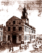
1771 Massachusetts Tax Inventory
 The following collection of data contains the names and descriptions of taxable property of nearly 38,000 individuals who resided in 152 Massachusetts towns in 1771. Data include enumerations of the type and value of real estate and buildings, as well as tabulation of livestock and farm commodities produced.
This on-line version allows you to browse the data by selecting items to view and "drilling down" through totals for counties and towns to the holdings of individual taxpayers.
An interactive map helps you locate towns and counties in the state. The map is based upon a map of Massachusetts drawn in 1792 and scanned from the Harvard University map collection. In order to use the map, you must install the Flash plug-in for you browser. The plug-in is free and available here.
Find individuals by typing in a first or last name View Records for Individuals with Probate Inventories
William Harper
Select items and view totals for counties, towns, and indiviudal town residents.
| Source: These data were obtained from original tax lists maintained by the state of Massachusetts as Massachusetts Archives, Volumes 132-134. The data in this collection were prepared by Bettye Pruitt, Philips Exeter Academy. The tax list has been published in its entirety (along with extensive discussions of Massachusetts tax laws and practices) as Bettye Pruitt (ed.), The Massachusetts Tax valuation List of 1771 (Boston: G.K. Hall and Co., 1978). The data for this Internet-based access tool are obtained from theUniversity Consortium for Political and Social Research, (ICPSR Study Number 7734) Anne Arbor, Michigan. The data are distributed by ICPSR in the form received from the original investigator. The data have been converted to a format appropriate for this Internet-based tool using the documentation distributed by the ICPSR, as donated by the original investigator. Programming developed by the Instructional Computing Group of Harvard University. |